
Precision aerial mapping and 3D modeling for engineering, construction, and land development.

HorizonMapping provides high-accuracy aerial mapping and spatial data solutions for projects of every scale. Using advanced drone photogrammetry and LiDAR technology, we produce survey-grade orthomosaics, digital surface and terrain models, detailed contours, and volumetric measurements. Our data supports grading and drainage design, site planning, progress monitoring, and environmental assessments—delivering actionable insights that reduce costs and speed decision-making for engineers, contractors, and planners.
Orthomosaic & High-Resolution Aerial Maps
What it is: Ultra-detailed, georeferenced aerial imagery stitched into a single seamless map.
Benefit: Provides an up-to-date, centimeter-accurate base map for design, documentation, and site planning.
LiDAR Point Clouds
What it is: Dense, georeferenced point data penetrating vegetation to reveal ground surface.
Benefit: Ideal for heavily wooded or complex terrain where photogrammetry alone can’t capture accurate elevations.
Change Detection & Progress Monitoring
What it is: Time-series comparisons of multiple flights.
Benefit: Tracks construction progress, erosion, and land-use changes with measurable accuracy.
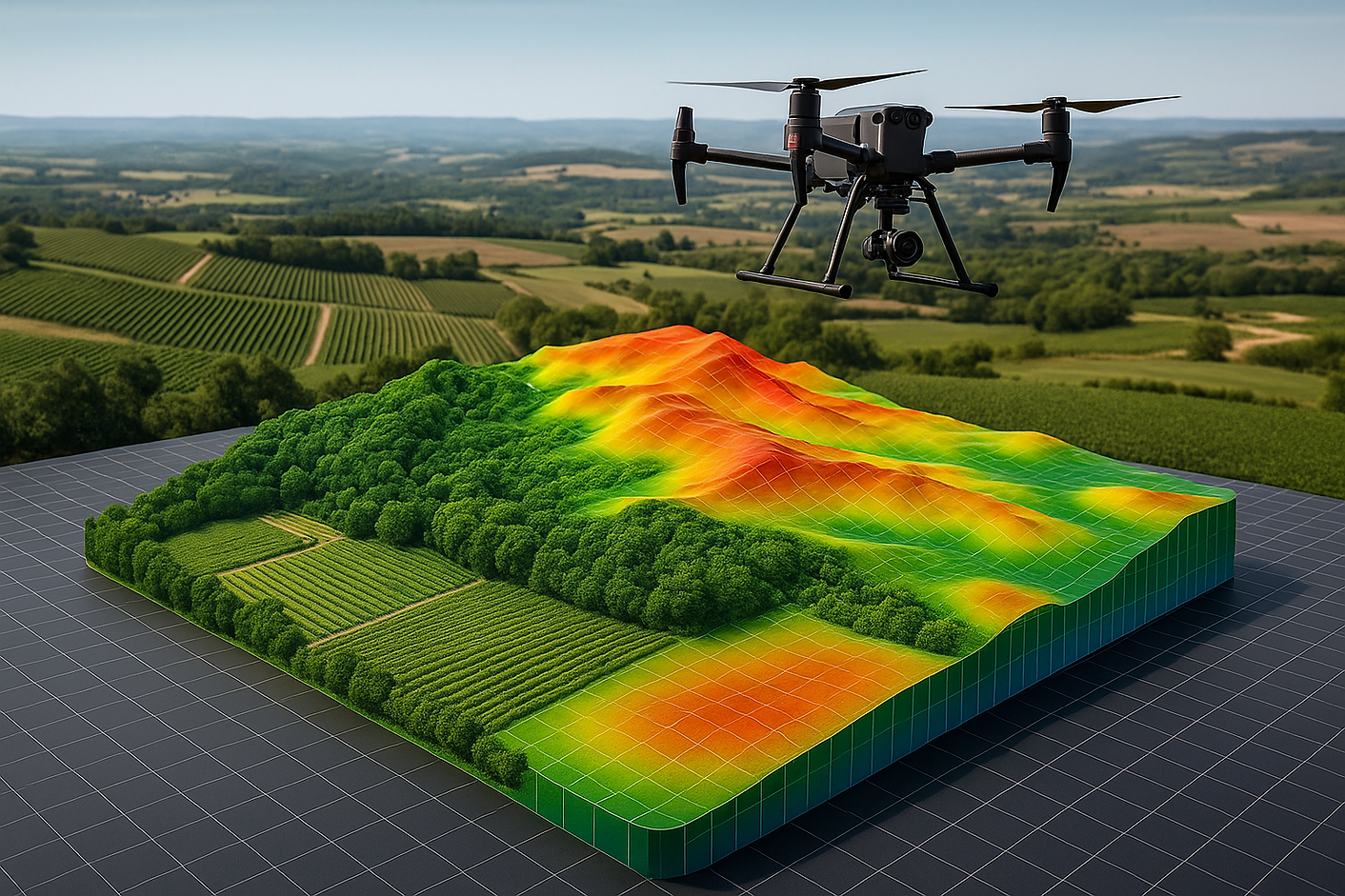
Digital Surface Models (DSM) & Digital Terrain Models (DTM)
What it is: 3D elevation models capturing both surface features (DSM) and bare-earth terrain (DTM).
Benefit: Enables accurate grading, drainage, and cut-and-fill calculations for engineering and construction projects.
Volumetric Analysis
What it is: Calculations of stockpile volumes, cut/fill quantities, and material movement.
Benefit: Saves time and money in mining, construction, and material management by providing precise volume measurements.
GIS & CAD Integration
What it is: Deliverables in industry-standard formats (GeoTIFF, LAS/LAZ, DXF, SHP).
Benefit: Seamless integration with AutoCAD, Civil 3D, QGIS, and ArcGIS for immediate use by engineers and planners.
Topographic Contour Mapping
What it is: Contour lines generated at user-defined intervals (e.g., 0.25–1 m).
Benefit: Supports site design, earthwork estimation, and storm-water management plans.
3D Mesh Models & Digital Twins
What it is: Interactive, photo-realistic 3D reconstructions of sites and structures.
Benefit: Enables virtual site visits, design visualization, and stakeholder presentations without repeated field trips.


HorizonVine
Precision Analytics for Vineyards

HorizonMapping
High-Accuracy Terrain Modelling

HorizonAgro
Data-Driven Crop Intelligence